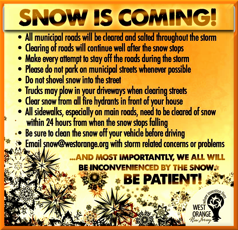
WINTER STORM WARNING Tuesday Midnight - Thursday morning 3/20 - 3/22


Roads in West Orange are lightly covered. Looks like they're drivable, though I'm just as happy not to drive them myself. I'm guessing we have 6" at most on the ground here so far.
I'm sort of surprised that I haven't heard anything about my flight at 8:45 tomorrow morning being canceled, but I guess the system will be out of here before then.

So far, it does not seem to be building up on the wires by me. Last time, there was a thick, heavy wrapping of snow around the wires that was causing them to droop dramatically.
What time are we expecting this storm to end tonight, Max?
I'm torn between pre-shoveling and waiting until it's all over on this one. I shovelled half-way through the last one and was really glad I did when I went to finish the rest, but we currently only have about 1/2 inch on the driveway/sidewalk and wine is calling.

ridski said:
What time are we expecting this storm to end tonight, Max?
I'm torn between pre-shoveling and waiting until it's all over on this one. I shovelled half-way through the last one and was really glad I did when I went to finish the rest, but we currently only have about 1/2 inch on the driveway/sidewalk and wine is calling.
More in South Orange, for sure.

ridski said:
What time are we expecting this storm to end tonight, Max?
I'm torn between pre-shoveling and waiting until it's all over on this one. I shovelled half-way through the last one and was really glad I did when I went to finish the rest, but we currently only have about 1/2 inch on the driveway/sidewalk and wine is calling.
One should never ignore the call of the wine signal.


ridski said:
What time are we expecting this storm to end tonight, Max?
I'm torn between pre-shoveling and waiting until it's all over on this one. I shovelled half-way through the last one and was really glad I did when I went to finish the rest, but we currently only have about 1/2 inch on the driveway/sidewalk and wine is calling.
I just saw the first snow plow go by on Prospect Street. That indicates that there may be enough snow on the ground to do a first pass if you want to get a jump on clearing tomorrow. I usually find it easier to clear before overnight freeze; but, given the expectation that the storm will continue into tomorrow, not sure that will hold. I did do a first pass simply because shoveling a little at a time is easier for me than doing it all at once. It really depends on how much you have to clear and how much weight you can handle in your shovel.
joan_crystal said:
ridski said:
What time are we expecting this storm to end tonight, Max?
I'm torn between pre-shoveling and waiting until it's all over on this one. I shovelled half-way through the last one and was really glad I did when I went to finish the rest, but we currently only have about 1/2 inch on the driveway/sidewalk and wine is calling.
I just saw the first snow plow go by on Prospect Street. That indicates that there may be enough snow on the ground to do a first pass if you want to get a jump on clearing tomorrow. I usually find it easier to clear before overnight freeze; but, given the expectation that the storm will continue into tomorrow, not sure that will hold. I did do a first pass simply because shoveling a little at a time is easier for me than doing it all at once. It really depends on how much you have to clear and how much weight you can handle in your shovel.
Right now I have an injured arm so I can't handle much weight at all but I'll do a quick run on the sidewalk now for those who are walking home and finish the rest tomorrow I think.

I just did the 1st shoveling and was glad I did. -I noticed that it is slushy at the bottom 1/2" and when that freezes hard overnight it would be a bit difficult to clear in the morning.
Meanwhile, it is actually quite pleasant out. -Not really cold and nice and quiet except a spring-like bird singing somewhere. Oh spring, where art thou?

just finished first pass, with snowblower. Took about an hour. Nothing like the last storm but not exactly light and fluffy either. I’m sure they’ll be another pass tomorrow but hopefully not too bad.
Good luck and be careful

This has been a pretty strange storm. Very convoluted evolution. Also weird how poorly it’s sticking to the roads. Still think a few more inches are possible, given the VERY slow movement of the low.
Edit: image won’t load :/

Just got this from Maplewood: "Advisory: The northbound lane of Wyoming Avenue will be closed between Claremont Avenue and Collinwood Rd. (Wires Down. PSE&G on scene)"

Well, I was going to say that I thought tomorrow’s delayed opening was a bit of an over reaction but perhaps not.

WxNut2.0 said:
This has been a pretty strange storm. Very convoluted evolution. Also weird how poorly it’s sticking to the roads. Still think a few more inches are possible, given the VERY slow movement of the low.
Edit: image won’t load :/
So, it's not over? More to come?
Anyone know if other areas in Jersey got hit worse? My daughter goes to shcool in Hoboken.

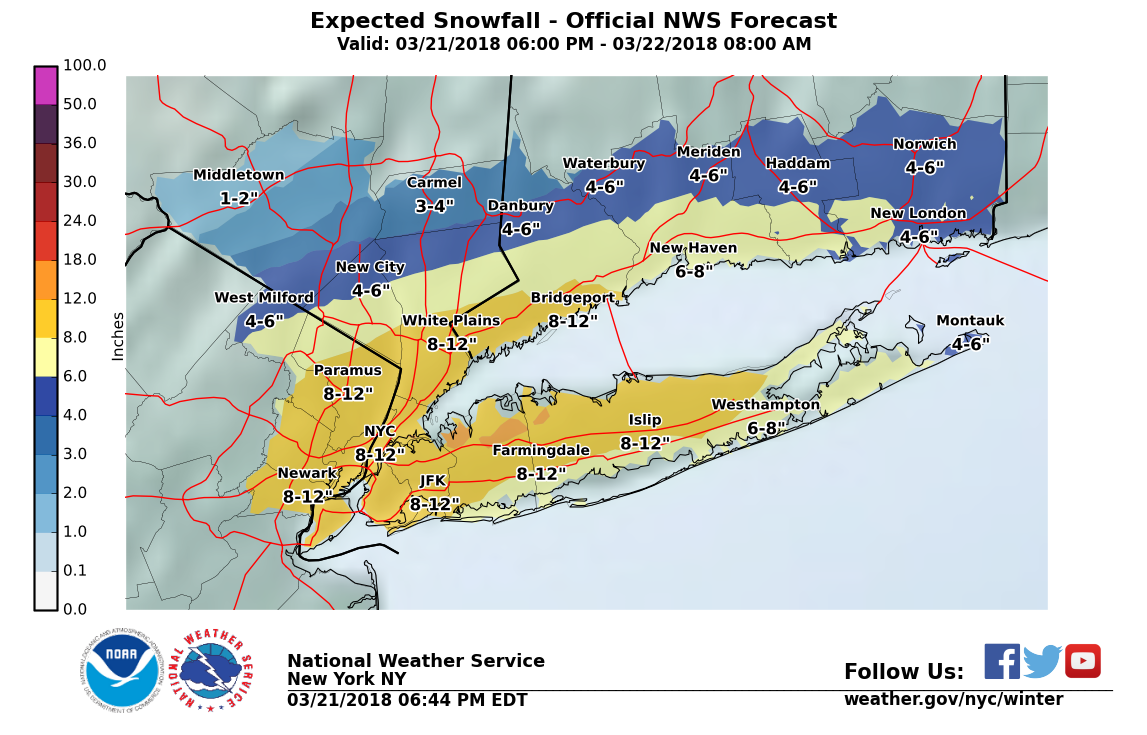
Late afternoon totals:
NEW JERSEY
...Bergen County...   Westwood               5.1   427 PM  3/21  Trained Spotter
            Elmwood Park           5.0   415 PM  3/21  Trained Spotter
            Englewood              4.9   540 PM  3/21  Trained Spotter
            Ridgewood              4.8   430 PM  3/21  Trained Spotter
            River Vale             4.2   415 PM  3/21  Trained Spotter
            Paramus                4.0   335 PM  3/21  Broadcast Media
            Hackensack             3.8   630 PM  3/21  Broadcast Media
            Hasbrouck Heights      3.5   420 PM  3/21  Trained Spotter
            Ramsey                 3.0   420 PM  3/21  Trained Spotter
...Essex County...   Cedar Grove            4.2   520 PM  3/21  Public
                     West Caldwell          3.5   430 PM  3/21  Social Media
...Hudson County...   Kearny                 7.1   400 PM  3/21  Public
                     Harrison               6.5   615 PM  3/21  Co-Op Observer
             Hoboken                6.4   620 PM  3/21  Trained Spotter
...Passaic County...   Hawthorne              3.5   400 PM  3/21  CoCoRaHS
                   Ringwood               3.3   420 PM  3/21  Trained Spotter
            Wanaque                2.5   500 PM  3/21  Trained Spotter
            Hewitt                 1.1   600 PM  3/21  Trained Spotter
...Union County...   Newark Airport         5.5   400 PM  3/21  FAA Observer
               Elizabeth              5.0   500 PM  3/21  Trained Spotter
            Union                  3.9   525 PM  3/21  Public
ETA Newark Airport reported 6.9" at 8:00pm.
This has indeed been a strange storm.
Since the serious banding did not develop this afternoon as feared, the NWS has lowered their snow totals as shown below, 8" - 12" in MAPSO. Unless we get hit by a band in the next four hours, though, I think we will be closer to 6 - 10".
Snow will be tapering off sometime between midnight and four tomorrow morning. Wind is still a bit gusty although should settle down soon.

I think I am breaking out the snowblower tomorrow morning. Not bothering tonight.
Storm Prediction Center is forecasting an uptick in snowfall here in the next couple of hours (technical discussion): http://www.spc.noaa.gov/products/md/md0165.html
With all due respect to the technical discussion, you can see it on the radar. But we are right on the western edge of where it is going, I think. It will be a race between the rotation and the low itself lifting NE.

max_weisenfeld said:
This has indeed been a strange storm.
Since the serious banding did not develop this afternoon as feared, the NWS has lowered their snow totals as shown below, 8" - 12" in MAPSO. Unless we get hit by a band in the next four hours, though, I think we will be closer to 6 - 10".
Snow will be tapering off sometime between midnight and four tomorrow morning. Wind is still a bit gusty although should settle down soon.
Just back from helping out my elderly parents in Chatham. Significantly less there, only a few miles west. I'd say 3 maybe 4 max on grass and elevated surfaces. Just a thin coating of slush on the roads. Route 78 and 24 very passable at 40-50 mph; nothing like the last storm.
bets said:
Seems like it's over? Delayed opening for SOMA schools...
It’s not over yet.
max_weisenfeld said:
With all due respect to the technical discussion, you can see it on the radar. But we are right on the western edge of where it is going, I think. It will be a race between the rotation and the low itself lifting NE.
The low is pretty much stalled.
Dry slot, such as it was, is filling in now. We should see some more snow soon.
For Sale
-

2007 Honda Fit $4,400
More info


Free Items

Sponsored Business


Promote your business here - Businesses get highlighted throughout the site and you can add a deal.

Mount Holly seems to be lowering its snowfall estimates towards the Max W line. Upton keeps holding on to the higher totals closer to the City.
No accumulation on the roads up here in Morristown, although the grass is completely covered again after being mostly exposed as recently as noon.
The snowfall rate has picked up considerably in the last fifteen minutes, and the wind is predominantly out of the north to northeast (d'uh!). I think we have been found by one of those heavy bands Max and WXNut keep warning us about. Visibility suddenly dropped radically. It has been fun, but it is now time for this stuff to pull off to the north and out of here--very tired of all this winter crap.